6/1/2024 HCS
NEWSFLASH !!!
New in June 2024, Truckee-Donner Historical Society now has DIGITAL access to the following maps available at this link. The index is full text searchable with links to the high resolution scanned maps.
We acknowledge with sincere gratitude to our donor Bo G. who made a very generous contribution to start digitizing our map collection. Bo was interested in seeing our maps about the Lake Tahoe Railway & Transportation Company rail line as he wrote a book about Tahoe City's "Hidden Waterfront." While we had several images available online about Tahoe City and the LTR&TCo. rail line, at the time, we did not have any digitized maps. We do now.
Thanks to Grant at Truckee's Tahoe Print Shop, almost all of the "L" series maps have been scanned.
We will continue to work on scanning maps labelled "B", "F", and "S" maps.
Map requests for the first 3 maps are free. Due to the unprecedented request for access to our online digital map collection, we implemented a policy that charges for full rights access (watermarked) to these maps starting July 1, 2023. After that, each map request will be $25.00. Due to the time intensive nature of these requests, please expect our turnaround time to take up to two weeks. Most requests are processed much sooner, but we are strapped for volunteer assistance and must dedicate our time equally to our other very important all volunteer work.
How to use the MASTER MAP INDEX.
An example is appropriate. Let's say you were interested in viewing maps of Donner Lake / Donner Park that have been digitized. Do a search within the Index to find the map you're interested in viewing, say
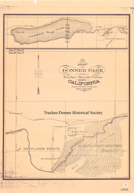
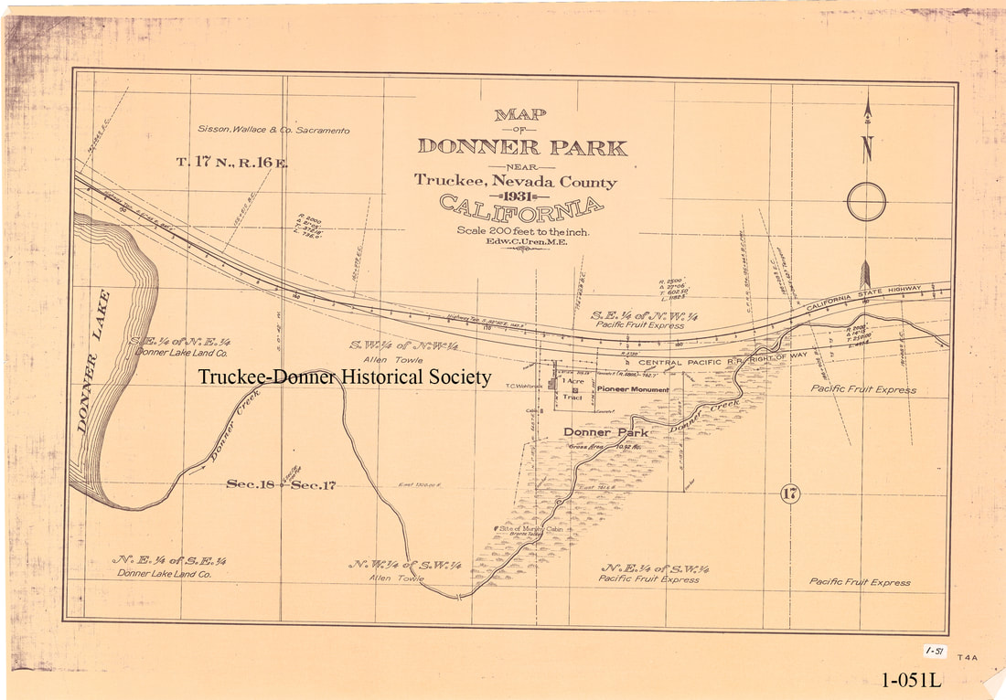
1-051L. We provide you with a watermarked high resolution map for viewing. See examples below. Do keep in mind that the maps were scanned at huge pdf sizes and are not easily emailed.
Compare Donner Park maps of 1920 and 1931. Have fun exploring, browsing, searching.


