|
1861 C.P.R.R. Map
One of our keen researchers - and you know who you are Ron - happened upon a “rolled” map, ink on linen, called “Location Map of the Line of the Central Pacific RR, Table of Alignments from Summit Sierras to Truckee River", available in full at this link, https://searchworks.stanford.edu/view/13130070. There are some very interesting identifying location notations on the 1861 map: "C.PRR Camp", "Dewey", "Strong & Judah", Donner Cabins and “Kings”. The map was prepared by The. D. [Theodore Dehone ] Judah, Chief Engineer, scale 400' pr inch, Oct. 10, 1861. The Manuscript map was created in 4 sections on one rolled sheet of ink on linen in preparation to construct the railroad across the Sierra Nevada Mountain Range in California. Note Theodore Judah (1826-1863) did not live long enough to see "his" plans materialize. Sadly, Judah died of yellow fever he contracted while crossing the Isthmus of Panama. The map includes table of alignments and Judah's proposed route, part of which were not built on this alignment. Take some time to explore this treasure. Full map title: HCS RR 6/7/2020 |
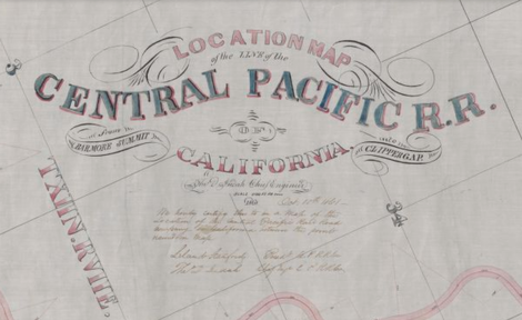
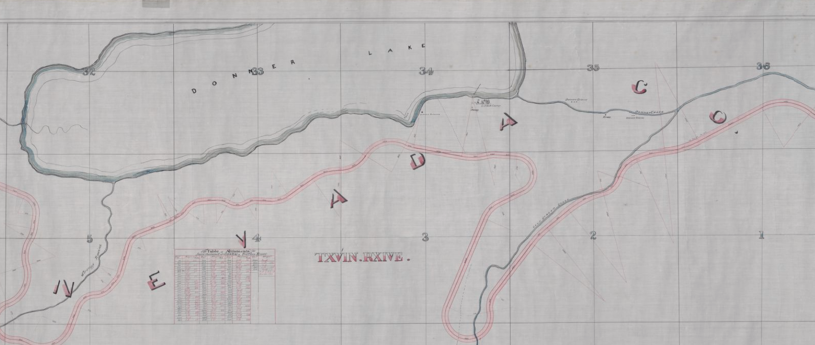
Complete map title "Central Pacific Railroad: proposed alignment (10 October 1861)". Stanford Digital Repository. Retrieved 7 June 2020. "[1] From Barmore Station to Clipper Gap -- [2] From Rattlesnake Bluffs to summit of Sierra Nevada -- [3] From summit of Sierra Nevada to Truckee River -- [4] From Dutch Flat to Rattlesnake Bluffs"
|
We Would Love to Have You Visit Soon! Please stop by the Joseph Research Library Cabin most Thursdays between 10 a.m. and 2 p.m. where our volunteers are hard at work.
|
|
HoursJoseph Research Library Cabin
Open most Thursdays 10 a.m. - 2 p.m. |
TelephoneP.O. Box 893
Truckee, CA 96160 (530) 582-0893 |
Email Site Map
[email protected] Site hosted by
|
© Truckee-Donner Historical Society 2015-2024. All Rights Reserved.